What’s the best way to enable lenders and appraisers to perform millions of real estate appraisals using comparable properties in the area? The answer for Lansdale, Pa.-based Global DMS®, is MapQuest for Business.
Automating the Entire Valuation Process
To help Global DMS users perform appraisals accurately and efficiently, the company developed eTrac®, a valuation management SaaS platform. eTrac automates every step in the collateral valuation process, including risk checks, compliance, appraisal data validation and valuation performance management.
Objectives:
-
Geocode over one million subject properties per year across the U.S. and Canada.
-
Identify the ideal appraisers for various properties based on their geographical location.
-
Display the subject property, comparable properties and listings on a map.
Location, Location, Location
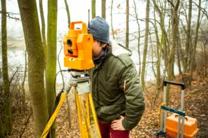
Every real estate professional knows that location is everything when it comes to the value of a property. Since a property’s valuation relies heavily on the value of comparable properties in surrounding areas, the accuracy of location data is critical. In addition, the U.S. Federal Housing Authority requires appraisers to have ‘geographic competency’ of the areas in which they perform appraisals. Using inaccurate location data to calculate the valuation of a property or to select an appraiser could spell disaster for the property’s buyer, seller or lender.
In 2008, Global DMS replaced its original geospatial services provider due to challenges with usability and overall capabilities. After evaluating several providers, the company ultimately chose MapQuest for Business. According to Global DMS CEO and President, Vladimir Bien-Aime, “MapQuest’s functionality and price point were far better than everything else we considered.”
Seeing the Big Picture
More than nine years later, MapQuest continues to provide the geospatial data that enables eTrac users to find the most geographically competent appraisers and comparable values for more than a million U.S. and Canadian properties annually. eTrac uses MapQuest’s Geocoding API to accurately calculate the distance between subject properties and comparable properties. When displaying the most geographically competent appraisers and all the property’s nearby features on a map, eTrac leverages MapQuest’s Static Map API. “MapQuest is really good at overlaying points of interest,” said Bien-Aime. “This makes it easy for buyers and appraisers to see the big picture of a property and its proximity to schools, churches, parks, shopping centers and other landmarks.”
Accurate Data Makes Happy Users
MapQuest has made an extremely positive impact on eTrac’s users. “Our users really like it,” said Bien-Aime. “Banks are happy because they’re covered with accurate comparisons performed by geographically competent appraisers. Homeowners are happy because they get the right value for the property.”
“MapQuest enables appraisals to be completed as efficiently as possible. It just works and we don’t have to think about it. No other solutions are more functionally-rich and stable than MapQuest for Business.”
–Global DMS CEO and President, Vladimir Bien-Aime
“MapQuest enables appraisals to be completed as efficiently as possible,” said Bien-Aime. “It just works and we don’t have to think about it. No other solutions are more functionally-rich and stable than MapQuest for Business.” His experience in working with MapQuest has been equally positive. “The people at MapQuest have always been very good to work with, in support and account management,” he said. “The MapQuest team is quick to work with us for all our needs. It’s been a really great relationship between Global DMS and MapQuest.”
Global DMS and eTrac are registered trademarks of Global DMS, Inc.