Since 2000, QTC has performed more than four million physical and diagnostic tests for U.S. veterans across the company’s 60+ office locations nationwide. Owned by Leidos, the Los Angeles, California-based company, QTC is the largest provider of government-outsourced occupational health and disability examination services in the U.S. QTC uses MapQuest for Business to help examinees quickly and easily locate the nearest provider.
Examinations for America’s Heroes
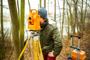
QTC provides a variety of employment-focused medical examinations and diagnostic testing services to clients in the private sector as well as federal, state, and local government agencies. The U.S. Department of Veterans Affairs, the U.S. Department of Labor and the U.S. Department of Health and Human Services are just a few of QTC’s government clients.
Objectives:
-
Quickly and accurately geocode examinees’ addresses into latitude and longitude coordinates.
-
Track mileage for QTC examiners visiting patients in the field.
-
Send map and driving directions to examinees via mobile device or portal.
Finding the Right Provider Quickly and Easily
Accurately routing and locating over 15 million searches for an examination provider per year requires a robust and precise geolocation engine. Geocode results from QTC’s previous provider were slow to be returned and inaccurate. The company recognized the need for a better geocode service with increased accuracy and speed of results for the military, civilian government and private sector users searching for an examination provider. In addition, QTC needed a way to accurately track mileage traveled by examiners visiting patients in the field.
MapQuest for Business is Called to Serve
QTC evaluated several alternatives to its legacy geolocation provider, but ultimately chose MapQuest for Business for three reasons: the availability of the application program interface (APIs) that could be easily integrated into QTC’s case management system workflows, the cost structure and flexibility of terms, and the speed and accuracy of geocode results.
Since integrating the MapQuest for Business Geocoding API into QTC’s case management system in 2015, user adoption has skyrocketed, exceeding QTC’s expectations. MapQuest’s Geocoding API automatically translates examination requests from addresses to latitude and longitude, the Search API identifies the nearest examiners within the predefined radius guidelines, and the Directions API returns turn-by-turn driving on a map to either a mobile device and QTC portal. For examinees traveling to QTC Clinics or Provider’s office locations, MapQuest’s Directions API tracks mileage within QTC’s case management system, automatically submitting mileage for reimbursement more accurately and timely than ever before.
“Our users really like the speed and accuracy of MapQuest’s results. Overall, we have increased our user satisfaction with this functionality by offering the ideal providers for our examinees with the accurate location functionality of the MapQuest engine.”
– Chief Information Officer at QTC, Nader Nemati
A Path to Success
QTC’s Chief Information Officer, Nader Nemati, reflects on the team’s choice of MapQuest for Business for QTC’s case management system: “Our users really like the speed and accuracy of MapQuest’s results in identifying the best and closest providers for our examinations. The MapQuest API system uptime and system resiliency has been strong and MapQuest has been very reasonable in partnering with us on the licensing model based on our volumes. Overall, we have increased our user satisfaction with this functionality by offering the MapQuest engine within our case management application.”