The MQ Developer Blog

Discover easy ways to improve your business needs using MapQuest's tools and gain insights into MapQuest use cases for various industries

Create customized and crisp maps with the new Static Map API

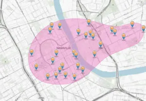
We recently launched an updated version of our Static Map API, including enhancements like you’ve never seen before. If you aren’t familiar, our Static Map API allows you to create a map image that can be placed in your applications, websites, email campaigns, or print media. Enhancements to Static Map API, v5, include:​ Retina Maps: Maps […]

Thomas Horacek

All Articles

How to Find North Without a Compass: 5 Simple Ways

Picture yourself lost in the wilderness without a compass. This scenario might seem unlikely, yet the ability to find north could prove vital for your survival at any moment. Modern technology has made us forget the ancient wisdom of direction finding. Our ancestors mastered the art of navigation using natural signs and celestial bodies to […]

Jenn Chu

How Are Maps Created: From Ancient Techniques to Cutting-Edge Technology

Maps have shaped human civilization for thousands of years and served as vital tools to explore, navigate, and understand our world. The art of creating maps has changed substantially over time. Simple drawings on clay tablets have evolved into sophisticated digital representations of Earth’s surface. These changes showcase humanity’s need for precise spatial information and […]

Jenn Chu

How to Create Accurate Noise Mapping for Your Area

Noise pollution is a growing concern in urban environments, affecting the quality of life and health of residents. As cities expand and human activities intensify, the need for accurate noise mapping becomes increasingly crucial. Noise mapping provides a visual representation of sound levels in an area, helping communities and policymakers understand and address noise-related issues […]

Jenn Chu

Dynamic Maps vs Static Maps: Key Differences Explained

Maps have come a long way from paper to pixels, transforming how we navigate and understand our world. The shift from static maps to dynamic maps has revolutionized the way we interact with geographical information, offering real-time updates and personalized experiences. This evolution has a significant impact on various industries, from transportation and logistics to […]

dynamic maps vs static maps
Jenn Chu

Traffic Congestion: Innovative Solutions for a Smoother Commute

We’re all familiar with the frustration of being stuck in traffic, watching the minutes tick by as we inch forward. Traffic congestion has become a daily headache for many commuters, impacting our productivity and quality of life. As urban populations continue to grow, this problem is only getting worse, making it crucial to find innovative […]

Jenn Chu

Maximizing EV Efficiency: Tips for Better Performance

Electric vehicles (EVs) are revolutionizing the automotive industry, offering a sustainable alternative to traditional internal combustion engine cars (ICE). As the world shifts towards cleaner transportation solutions, EV efficiency has become a crucial factor in their widespread adoption. Maximizing the performance and range of electric vehicles not only enhances the driving experience but also contributes […]

Jenn Chu

What is the difference between latitude and longitude?

In the realm of geographic navigation and positioning, the concepts of latitude and longitude stand as fundamental principles guiding us across the complex surface of our planet. These two sets of lines not only demarcate positions on Earth but also play a pivotal role in the fields of GPS technology, time zones management, and global […]

Jenn Chu

Why Route Optimization is Critical for Operational Success

In today’s fast-paced business landscape, route optimization software and APIs offer a game-changing solution for enhancing operational efficiency and driving cost savings. When your drivers have hundreds, if not thousands, of destinations or clients to visit, planning routes manually becomes a time-intensive and inefficient solution. Route optimization benefits extend far beyond just reducing travel distance […]

Jenn Chu

The Science Behind GPS: How Does It Work?

The Satellite Network GPS operates through a constellation of satellites that are strategically positioned in medium Earth orbit. This network includes at least 24 operational satellites at all times, ensuring global coverage and providing users with precise navigation and timing services 1. Each satellite orbits the Earth approximately twice a day at an altitude of about […]

Jenn Chu

Explore more

  • FAQ

    Have a quick question you’re sure that others have asked before? Check our FAQ.

  • Contact us

    Have a suggestion or a question that you can't seem to find the answer to? Contact us.

Ready to get started?

Get started with MapQuest’s industry-leading geospatial and mapping services in a few quick steps.